Looking Back at the Protection of the Arthur Iversen Conservation Area
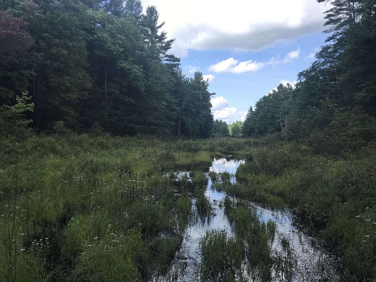
At 561 acres, the Arthur Iversen property in Warwick is by far Mount Grace’s biggest Conservation Area. Its hemlock and oak forests contain long stretches of Hodge Brook and Rum Brook; miles of trails past an assortment of wetlands, vernal pools, and ponds, including active beaver ponds; and the seasonally spectacular Washbowl waterfall. Assembling and stewarding this protected forest has been a big part of the history of Mount Grace Land Conservation Trust, beginning with the conservation of the first 29 acres by Myra Iversen in February of 1990 in memory of her husband Arthur.
Neighbor David Spackman remembers Myra Iversen as “just the most delightful lady. She loved her house, she loved showing it off, she loved our kids because she and Arthur never had any children, and she really, really loved the land.” Spackman, who bought the land next door in the 1980s with his inheritance from his grandfather, was inspired by Myra’s example to protect his land as well in 1991.
Today a short, relatively flat, trail from Gale Road takes walkers to a bridge at Rum Brook and beyond into the Spackman and Iversen parcels east of the brook. Both are managed in accordance with sustainable forestry principles. The forest management plan aims to promote an uneven-aged forest with diverse species and age classes of trees, and the area is distinguished by tall closed-canopy groves of older northern hardwood, white pine, and hemlock forest interspersed with clearings of early successional forest. The trail is a 1.5-mile round trip.
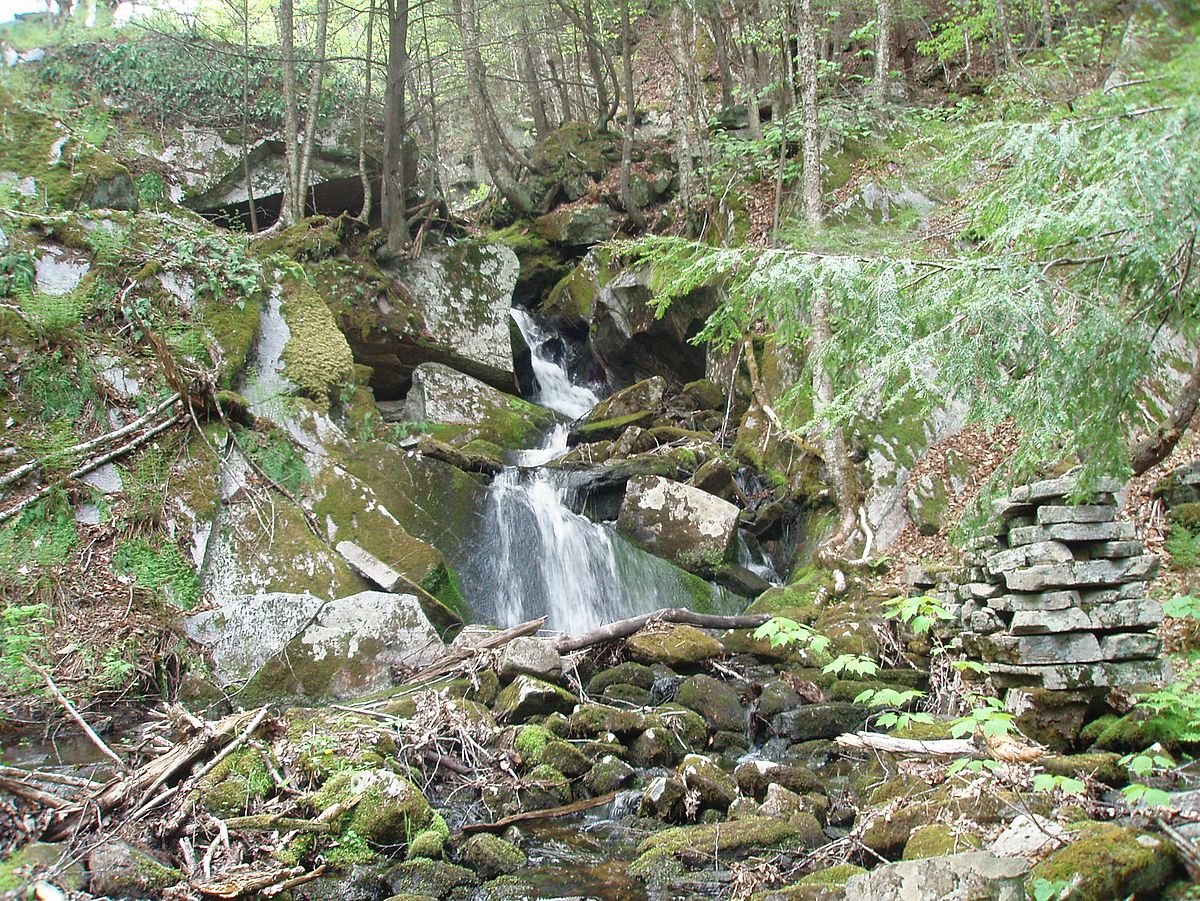
A much steeper trail heads west from Gale Road, beginning as a wide road—remnants of a branch of the former Massachusetts Fifth Turnpike connecting Athol to Northfield and established in 1799—down to Hodge Brook, where walkers cross the wetlands on stepping stones and then ascend a footpath on their way to the Washbowl Waterfall. Here Hodge brook takes a 20+ foot tumble over a series of rocky outcrops as it makes its way towards its eventual confluence with Gales Brook. The Washbowl is best viewed in late April after snowmelt, or is an ideal destination for a hike on the first clear day after rain has kept you indoors. The trail crosses Hodge Brook upstream from the falls and then returns out to Gale Road, for a total of 2.3 miles on the trail plus an additional .9 miles down Gale Road back to the trailhead.
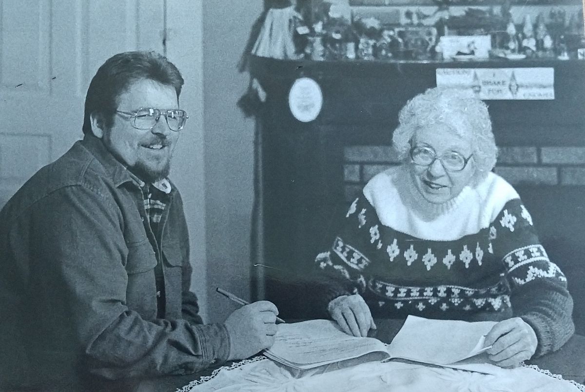
The woods seen from this trail, and indeed most of the lands that now make up the Arthur Iversen Conservation Area, were protected in 1994, the culmination of talks with several local landowners including David Spackman. As Mount Grace Founder Keith Ross explains: “Allen Young would always encourage us to make sure every Mount Grace project got published in the paper, and when the article about Myra Iversen’s land appeared in the Athol Daily News sure enough we got a call from Betty Earle asking if we’d be able to help her protect her land. And then wouldn’t you know it Dave Zellmer saw all the conservation going on and he wanted to be involved too.”
Earle and Zellmer ultimately joined the Maynard and Savoury families to protect hundreds of acres of forest in the 1990s. Most was added to the conservation area, but one large piece to the south became part of the Warwick State Forest at the behest of Betty Earle. Iversen is thus part of a contiguous stretch of protected land that extends from Orange, Massachusetts up into New Hampshire, containing thousands of acres of forests, fields, and wetlands.
Forging these north-south corridors of protected land is a key element of Mount Grace’s strategy for long-term regional resilience in the face of climate change. Large contiguous areas of diverse protected natural communities offer more opportunities for survival of diverse species than smaller pockets of land cut apart by development, while the north-south orientation means species that require colder temperatures can move north as the planet warms.
One particularly unusual natural community found at Iversen is the circumneutral talus slope—steep slopes formed on rocks high in calcium carbonate. Iversen boasts two examples, one near the trail north of the Washbowl and a second found in an eight-acre parcel at the extreme southwest of the property transferred to Mount Grace by the Blackbird family in 2008.
The Blackbird parcel is a steep-sided valley that falls away from a rocky ridge running parallel to Hastings Pond Road down towards Hodge Brook as it continues through the Warwick State Forest. The valley can be reached by following deer paths carefully down the hill. The old oak, ash, and cherry trees on the slope and valley floor are sheltered from the wind, and since the hillsides are steep, have not been extensively cut. The slopes are dotted with porcupine dens and provide ideal bobcat habitat.
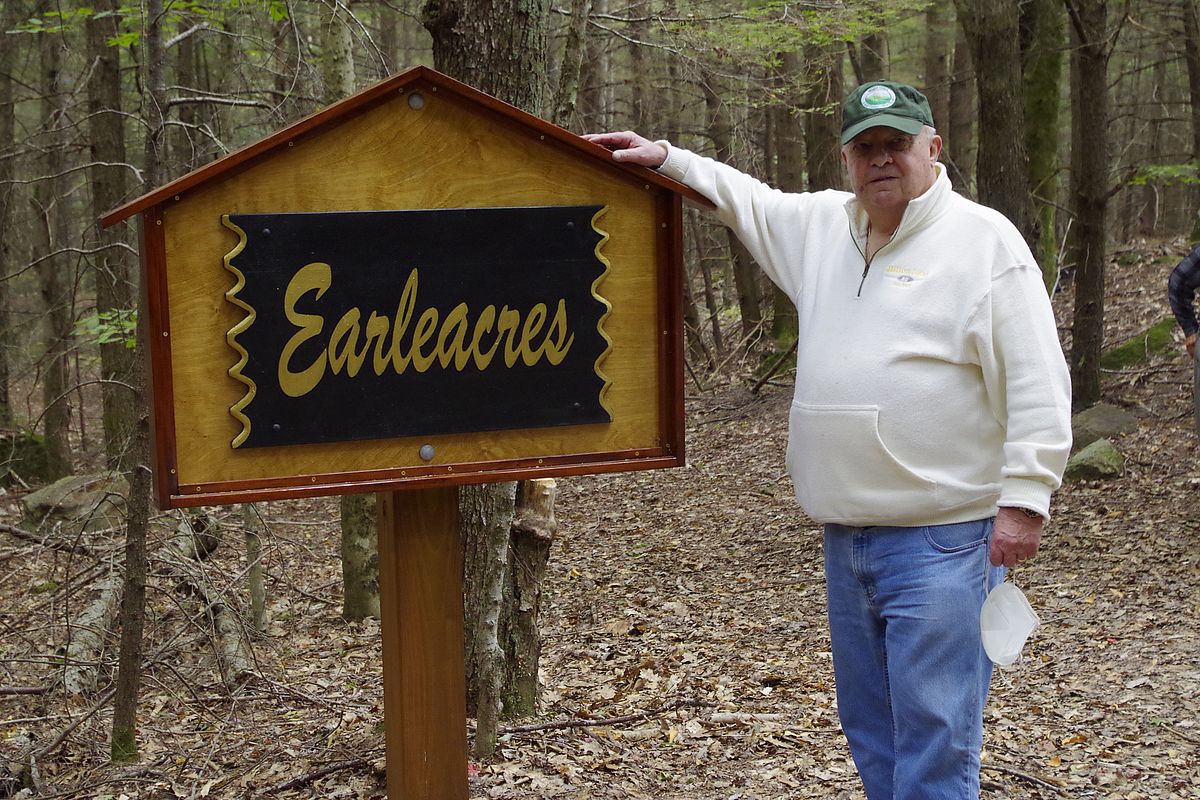
The latest addition to Iversen is more easily reached, being just off Gale Road. It’s also a return to the roots of the project, since it was donated to Mount Grace in 2019 by Larry Fitzmaurice, nephew of Betty Earle. Access this 50-acre wetland with an easily walkable woods road running through it by parking at the sign for Earleacres on the eastern side of Gale Road.
Larry’s grandfather Harry Earle moved to Warwick after working as an engineer at the Rodney Hunt Company in Orange. Over time he acquired 365 acres of land along Gale Road, which he named Earleacres. “Grampa Earle had a great appreciation of the land,” says Larry. “He was raised in Detroit and really came to appreciate nature. He always took good care of the land and instilled in us all a love for the unspoiled land and what it had to offer.”
That same love of the land carried down through the generations is a big reason why this diverse group of neighbors have all chosen to protect this cherished place forever. Larry Fitzmaurice still remembers his childhood summers in the 1940s spent walking with his brother Shaun, each outfitted with an empty Quaker Oats box slung from his neck by string which they filled with blueberries from the abundant bushes along the way.
Asked what motivated him David Spackman recalls walking on the land with his daughters each spring: “Once the snow was gone we would walk down the trails and the kids would always find red efts and collect them in jars and we’d keep them for an hour or so and then we’d remind the kids that red efts don’t really want to be in jars and then we’d walk back out on the trails and let them go. The chances of the place being developed felt pretty small, but it represented my inheritance from my grandfather and I never wanted to see it lost.”