Arthur Iversen Conservation Area
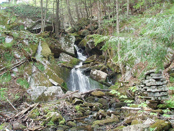
In the east shadow of nearby Mount Grace, the Arthur Iversen Conservation Area (AICA) is within the Hodge and Rum Brook watersheds. Pieced together with the help of eight landowners, the nearly 600-acre natural mosaic encompasses an ecosystem supporting several threatened birds and plants and has inspiring landscape features like a stunning waterfall, beautiful brooks, and wonderful wetlands.
There are two hiking trails to explore: the Washbowl Falls Trail and the Rum Brook Trail.
The 2.3-mile Washbowl Falls Trail begins on the west side of Gale Rd. From the kiosk, the trail goes through the hemlock hardwood forest to a small beaver pond on Hodge Brook. A variety of flora and wildlife can be found here, including colorful late summer wildflowers. Continue along the rim of the brook basin to view the Washbowl and a seasonal waterfall. The trail continues through the woods back to Gale Rd. Take a right (south) onto Gale Rd to return to the trail head.
A second trail begins on the east side of Gale Rd beginning at a gate. An easy northeast walk leads to a foot bridge for an open view of the Rum Brook wetland and a view of a habitat management conducted in 2016 to create early successional habitat for birds that prefer young forest to nest, forage, and breed.
Public Access
The AICA is open to the public for non-motorized outdoor recreation including hiking, bird watching, and nature study. Because the AICA is an amalgamation of different parcels donated or sold to Mount Grace by different landowners between 1991 and 2019, hunting and fishing are only allowed on the southeast parcel, east of Gale Road.
Directions
67 Gale Rd, Warwick, MA 01378
From the junction of routes 2A and 78 west of Orange center, follow Route 78 north to Warwick center. Turn right on Athol Rd, and follow it 0.8 miles to another right on Gale Rd. Continue along Gale Rd for 1 mile to the kiosk for the Washbowl Falls trail on the right, and another 0.1 miles to the Rum Brook trail on the left.
Note: The AICA is only accessible from Athol Rd by car as the bridge to the south on Gale Rd is closed.
Parking is available on the side of Gale Road in front of trail heads.
Ownership
Mount Grace Land Conservation Trust
Gifts From
Myra Iversen (1991) and Lawrence Fitzmaurice (2019)
Year(s) Protected
1991-2019
Property History
Protection of the area began in 1988 when Myra Iversen worked with Mount Grace to develop a conservation plan for her property in honor of her late husband, Arthur. Neighbors heard of the plan and subsequently sold their land to us also. More acquisitions occurred in 1994 when Mount Grace, Myra, the MA Dept. of Conservation and Recreation, Sweet Water Trust, and individual donors expanded the AICA to more than 500 acres. Earleacres, the last fifty acres of woods and wetlands in the center of the AICA, was conserved in 2019.


