5 Scenic Hikes for Fall Foliage in North and Central Massachusetts

It’s official—leaf-peeping season has arrived, and we couldn’t be more excited! As hot summer nights give way to cool autumn evenings, forests across north and central Massachusetts explode with color. Stirred by the cold, maple trees transform into a fiery blaze, while stands of birch glow golden beneath the sky. Colorful leaves flutter down to the forest floor, landing on the heads of hikers and on the backs of black bears as they wander through forests and past fields.
The spectacular blend of deciduous and coniferous trees in our region make for some of the country’s best fall foliage. So to celebrate another year of magic foliage, here are five of our favorite autumn hikes.
Note: If you plan on hiking during hunting season, please be sure to wear blaze orange.
1. Tully Mountain
- Location: Orange, MA
- Trailhead: Mountain Road parking area marked “Tully Mountain Wildlife Management Area.”
- Property managed by: Massachusetts Division of Fisheries and Wildlife
- Distance: 1.5-mile loop
- Difficulty: Moderate / Hard
A short but steep hike with incredible panoramic views of the surrounding forests and hills, especially stunning in the fall. The summit offers sweeping views of Tully Lake and the colorful tapestry of the region's foliage. The view from the rocky ledges at the top also includes Mount Monadnock on the northern horizon, with its barren summit clearly visible.
This loop features a moderate climb along the Tully Trail to the ledges and a short but steep descent on the return route. Those looking for a good workout or a short, direct, .25-mile route to the summit may wish to do this hike in reverse. It’s common practice for people to hike up the steep ascent and down the gradual. Be aware that the steep ascent is quite rocky and can be slippery when wet or covered with autumn leaves.
Here’s the AllTrails route.
Note: Exercise caution on the rocky summit — the ledges have steep drop-offs.
2. Arthur Iversen Conservation Area
- Location: Warwick
- Trailhead: Parking along west side of Gale Road
- Property managed by: Mount Grace Land Conservation Trust
- Distance: 2.4 miles
- Difficulty: Easy
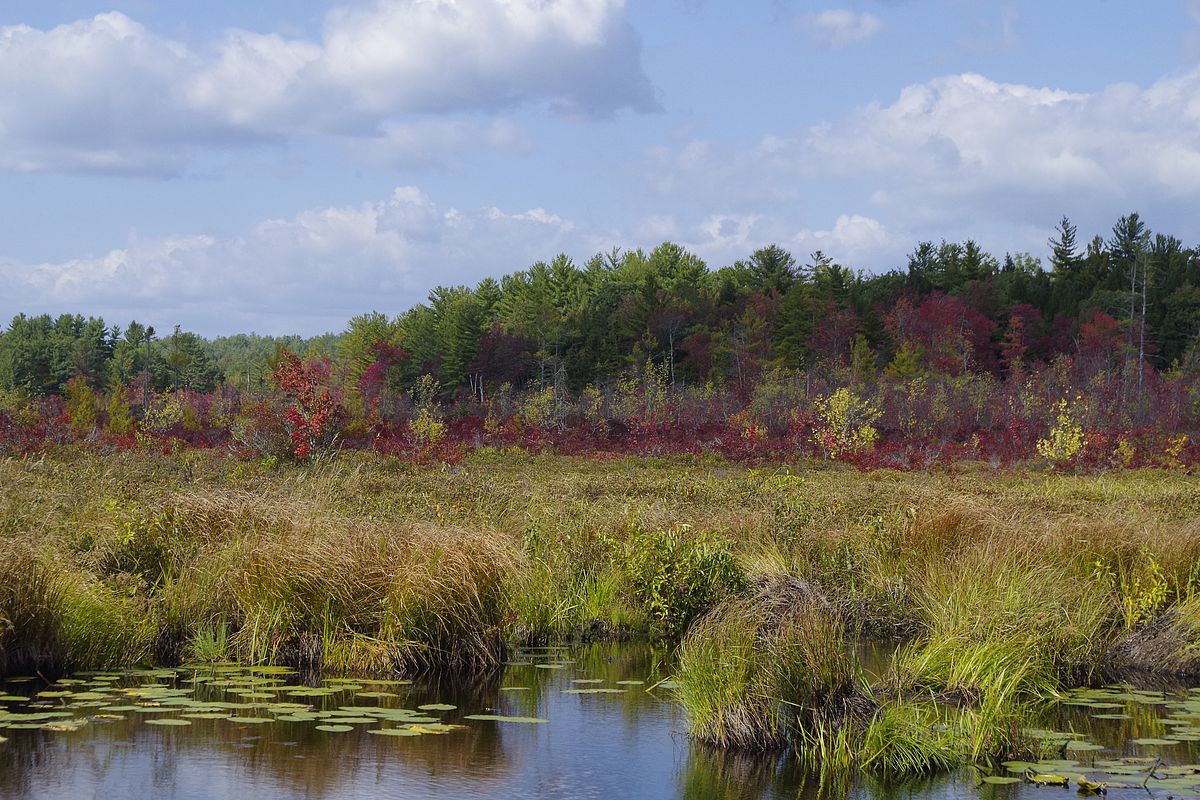
Washbowl Trail – the most popular trail in Arthur Iversen – offers visitors solitude within this beloved 500-acre forest and can be made into a loop by following Gale Road back down to the parking area. It’s a perfect trail to avoid crowds and along the way, you’ll pass by wetlands and an ephemeral waterfall.
Across the road from the Washbowl, more fall color can be found at Earleacres, which includes the wetlands of Rum Brook and can be reached via the old woods roads behind the Earleacres sign on the east side of Gale Road.
Here’s the AllTrails route. For more information about the Arthur Iversen Conservation Area, click here.

3. Mount Watatic
- Location: Ashburnham
- Trailhead: Watatic Parking Lot off Route 119, Ashburnham, MA
- Property managed by: The Mount Watatic Reservation is managed by a partnership of several entities, including the Massachusetts Department of Conservation and Recreation (DCR), the Massachusetts Division of Fisheries and Wildlife (DFW), and the towns of Ashby and Ashburnham.
- Trail: Mount Watatic via Midstate Trail
- Distance: 2.1 miles
- Difficulty: Challenging
- Map: Explore on AllTrails
A classic monadnock, Mount Watatic stands alone on the landscape and rewards hikers with sweeping 360-degree views from its open summit. Whether you're chasing a heart-pumping climb or just looking for a short adventure with big payoffs, Watatic delivers. Here’s everything you need to know about this scenic mountain hike, including some critical information about parking.
The most popular and direct route to the summit of Mount Watatic is via the Midstate Trail. The trail begins flat as it passes through a swampy area with a small pond, then steepens gradually. The trail is mostly wooded until you reach the summit, which is marked by a large cairn.

4. Skyfields Arboretum
- Location: Athol, MA
- Trailhead: Parking lot is located just past the Mount Grace Land Conservation Trust office
- Property managed by: Mount Grace Land Conservation Trust
- Distance: Variable
- Difficulty: Easy
Every October, the 40 acres of rolling meadows and mixed-deciduous forest surrounding the headquarters of Mount Grace Land Conservation Trust burst into a kaleidoscope of color. The wide array of tree species found at Skyfields makes it the perfect spot to enjoy every species’ unique fall time color.
5. Fox Valley Wildlife Sanctuary
- Location: Phillipston
- Trailhead: Right side of Lincoln Road
- Property managed by: Mount Grace Land Conservation Trust
- Distance: 1.3-mile loop
- Difficulty: Easy
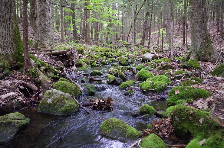
Fox Valley is a 103-acre wildlife sanctuary in Phillipston that’s open to the public for non-motorized outdoor recreation including hiking, bird watching, and nature study. The trail is rustic, yet it captures the essence of Massachusetts in the fall: winding stone walls, a bubbling brook, and vibrant hardwood trees that all display their unique autumn colors.
Here’s the AllTrails route. You can find more information about the property on our website, or by clicking here.